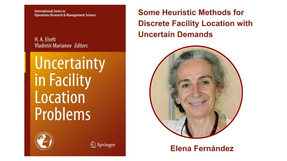
<?xml version="1.0" encoding="utf-8"?><feed xmlns="http://www.w3.org/2005/Atom" ><generator uri="https://jekyllrb.com/" version="3.10.0">Jekyll</generator><link href="https://weathernavigation.com/feed.xml" rel="self" type="application/atom+xml" /><link href="https://weathernavigation.com/" rel="alternate" type="text/html" /><updated>2025-07-30T02:12:47-07:00</updated><id>https://weathernavigation.com/feed.xml</id><title type="html">Weather Navigation</title><subtitle>personal description</subtitle><author><name>Weather Navigation</name></author><entry><title type="html">New publication on the design of LNG and LPG ships</title><link href="https://weathernavigation.com/news/2025/lng-lpg-design" rel="alternate" type="text/html" title="New publication on the design of LNG and LPG ships" /><published>2025-10-15T00:00:00-07:00</published><updated>2025-10-15T00:00:00-07:00</updated><id>https://weathernavigation.com/news/2025/lng-lpg-design</id><content type="html" xml:base="https://weathernavigation.com/news/2025/lng-lpg-design"><![CDATA[<p>A new research paper co-authored by members of the Weather Navigation team has been published in <em>Marine Structures</em> (Elsevier, Vol. 104, October 2025). The study addresses a key challenge in modern ship design: how to improve the <strong>preliminary design process for LNG and LPG ships</strong> by leveraging statistical models and machine learning.</p>

<p>The paper, authored by researchers from <strong>Universidad de Cádiz</strong> and <strong>IE University</strong>, analyzes a unique industrial dataset of 467 gas carriers built between 1979 and 2023 by Hyundai Heavy Industries. The database includes 145 LNG and 322 LPG ships, representing roughly <strong>20% of the global fleet</strong>, and offers a rare empirical foundation to explore the complex relationships between ship dimensions, deadweight, speed, and hull ratios.</p>

<p><img src="https://danielprecioso.com/images/2025-10-15-marine-structures.jpg" alt="LNG/LPG design publication" width="100%" /></p>

<p>The work explores how <strong>simple and multiple regression analyses</strong>, using functional forms such as linear, exponential, and logarithmic regressions, can be used to derive predictive formulas for key ship characteristics. These are benchmarked against <strong>machine learning algorithms</strong>, which show promise in capturing hidden, non-linear dependencies in the data, though with less interpretability compared to traditional methods.</p>

<p>From a practical standpoint, the results provide <strong>designers and engineers with updated predictive tools</strong> for estimating main ship dimensions in the early design stage. This is especially valuable in an industry where prototypes are not constructed, and accurate early estimates are critical to avoid costly redesigns. The models help optimize design choices based on known constraints, such as port limits, energy consumption, and regulatory frameworks.</p>

<p>This publication also contributes to the scientific effort to support <strong>low-emission maritime transport</strong>, given the rising role of LNG and LPG as transitional fuels. The improved design tools can guide more energy-efficient and sustainable vessel construction.</p>

<p><a href="https://doi.org/10.1016/j.marstruc.2025.103863" class="button">Read the new paper here</a></p>

<p>This research is supported by:</p>

<ul>
  <li>
    <p><a href="https://www.fbbva.es/">BBVA Foundation</a> via the project “Mathematical optimization for a more efficient, safer and decarbonized maritime transport”.</p>
  </li>
  <li>
    <p>Spanish <a href="https://www.aei.gob.es/">Agencia Estatal de Investigación</a> under grant  TED2021-129455B-I00, “Optimization of maritime routes with real time oceanographic and meteorological data”.</p>
  </li>
</ul>]]></content><author><name>Weather Navigation</name></author><category term="publications" /><category term="naval architecture" /><category term="data science" /><category term="machine learning" /><category term="marine structures" /><summary type="html"><![CDATA[The Weather Navigation team publishes a new study on statistical and machine learning tools for the preliminary design of LNG and LPG carriers, based on a large-scale industrial dataset.]]></summary></entry><entry><title type="html">Weather Navigation featured in The Conversation Weekly</title><link href="https://weathernavigation.com/news/2025/the-conversation" rel="alternate" type="text/html" title="Weather Navigation featured in The Conversation Weekly" /><published>2025-03-27T00:00:00-07:00</published><updated>2025-03-27T00:00:00-07:00</updated><id>https://weathernavigation.com/news/2025/the-conversation</id><content type="html" xml:base="https://weathernavigation.com/news/2025/the-conversation"><![CDATA[<p>This month, Daniel Precioso from the Weather Navigation team was featured on an episode of <a href="https://theconversation.com/a-google-maps-for-the-sea-sails-and-alternative-fuels-the-technologies-steering-shipping-towards-lower-emissions-podcast-253088"><em>The Conversation Weekly</em></a>, a global podcast that brings together expert voices on some of today’s most pressing global challenges.</p>

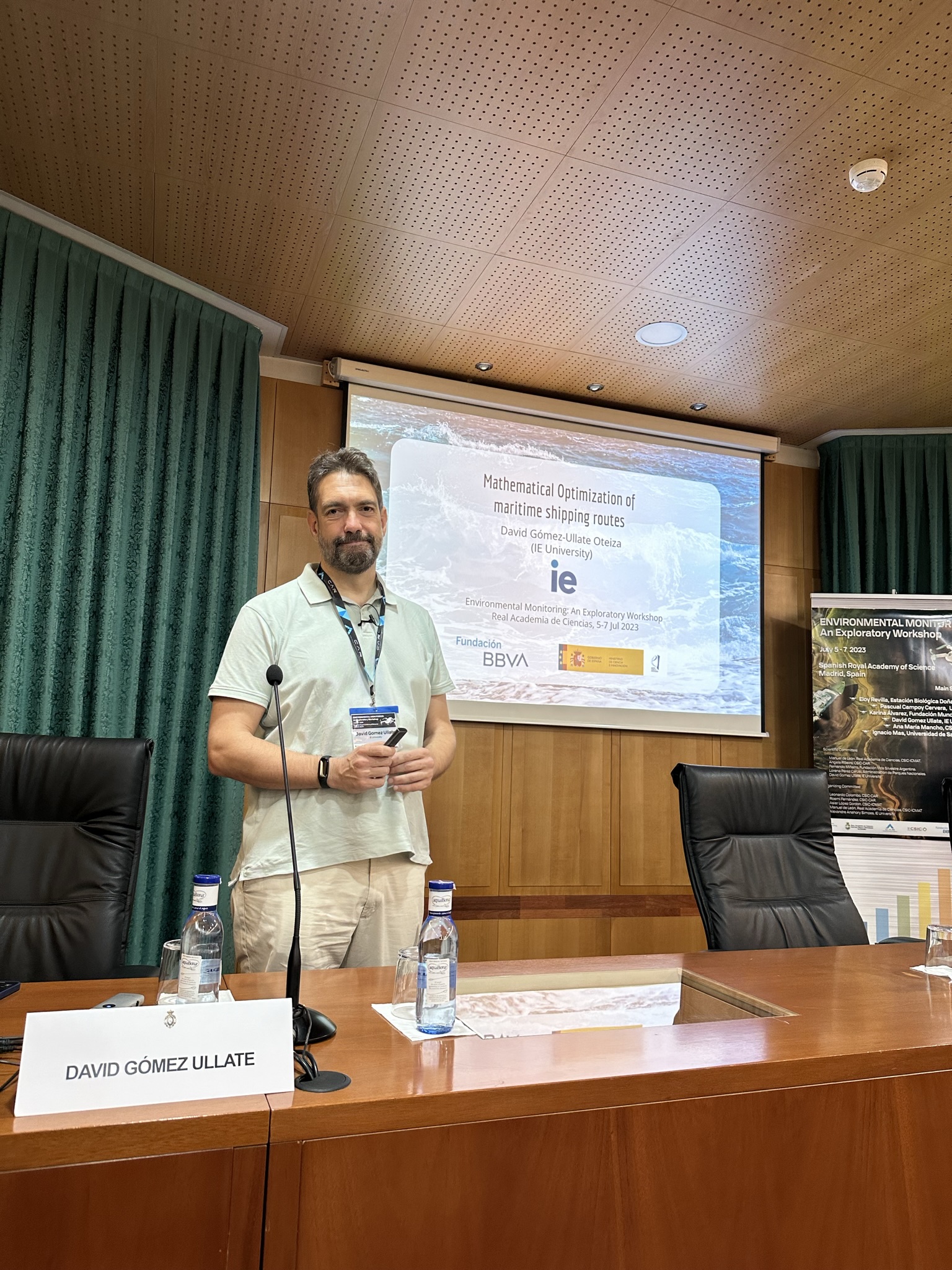
<p>In this episode, Daniel presented our research on maritime routing algorithms. We leverage real-time environmental data (such as wind, wave, and ocean current forecasts) to support lower-emission, safer, and more efficient shipping. These optimization techniques are designed to reduce fuel consumption and travel time, offering practical tools for the transition toward a more sustainable maritime sector.</p>

<p>He was joined by Professor Alice Larkin from the University of Manchester, who contributed a broader view on decarbonizing the shipping industry, from sail-assisted propulsion to the future of alternative fuels.</p>

<p><img src="https://danielprecioso.com/images/2025-03-27-the-conversation.jpg" alt="The Conversation Weekly" width="100%" /></p>

<p>Daniel’s participation in the podcast follows his involvement in an interdisciplinary research initiative between <strong>IE University</strong> and <strong>Universidad de Cádiz</strong>, focused on the <strong>optimization of maritime routes</strong> for safer, more efficient, and more sustainable transport. This ongoing project aims to develop high-precision routing algorithms using real-time environmental data from sources like NOAA, Copernicus, and HYCOM. The models integrate vessel-specific parameters (such as displacement, hull geometry, and engine specs) with ocean conditions to estimate fuel usage and CO₂ emissions.</p>

<p>This research is supported by:</p>

<ul>
  <li>
    <p><a href="https://www.fbbva.es/">BBVA Foundation</a> via the project “Mathematical optimization for a more efficient, safer and decarbonized maritime transport”.</p>
  </li>
  <li>
    <p>Spanish <a href="https://www.aei.gob.es/">Agencia Estatal de Investigación</a> under grant  TED2021-129455B-I00, “Optimization of maritime routes with real time oceanographic and meteorological data”.</p>
  </li>
</ul>

<p>You can listen to the full podcast episode <a href="https://theconversation.com/a-google-maps-for-the-sea-sails-and-alternative-fuels-the-technologies-steering-shipping-towards-lower-emissions-podcast-253088">here</a>.</p>]]></content><author><name>Weather Navigation</name></author><category term="weather routing" /><category term="optimization" /><category term="shipping" /><category term="emissions" /><category term="the conversation" /><summary type="html"><![CDATA[Daniel Precioso spoke about Weather Navigation and maritime decarbonization in The Conversation Weekly podcast.]]></summary></entry><entry><title type="html">New Publication in Ocean Engineering</title><link href="https://weathernavigation.com/news/2025/hadad" rel="alternate" type="text/html" title="New Publication in Ocean Engineering" /><published>2025-01-01T00:00:00-08:00</published><updated>2025-01-01T00:00:00-08:00</updated><id>https://weathernavigation.com/news/2025/hadad</id><content type="html" xml:base="https://weathernavigation.com/news/2025/hadad"><![CDATA[<p>We are thrilled to kick off 2025 by announcing our newest scientific contribution. Our team has just published the paper “HADAD: Hexagonal A-Star with Differential Algorithm Designed for weather routing” in the journal of Ocean Engineering.</p>

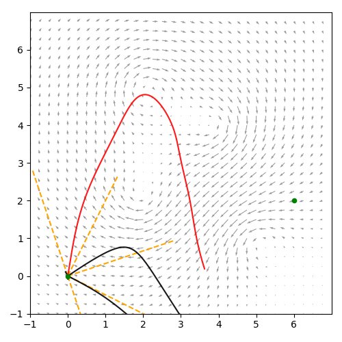
<p>Weather Navigation focuses on developing cutting-edge optimization methods to address the challenges of weather routing. In this publication, we introduce HADAD (Hexagonal A-Star with Differential Algorithm Designed for weather routing), a novel approach that first applies an A* search on a hexagonal grid with extended neighbor relationships, allowing more directional flexibility than standard graph-based searches. This global exploration is then refined by a discrete Newton–Jacobi variational technique, guaranteeing convergence to a locally optimal, smoothly curved path in continuous space.</p>

<p><img src="https://weathernavigation.com/images/2025-01-01-hadad.jpg" alt="HADAD" width="100%" /></p>

<p>To assess HADAD’s performance, we compiled a comprehensive benchmark of 1,560 test scenarios covering an entire year, featuring diverse origin-destination pairs, vessel speeds, and environmental conditions. Our findings indicate that HADAD provides an additional 4% improvement over pure A* graph methods compared to the shortest-distance route, thanks to its flexible, gradient-based refinements. A seasonal analysis reveals markedly higher gains in winter, sometimes doubling those in summer, with savings peaking at 27% under extreme weather. Additionally, testing the algorithm with synthetic vector fields demonstrated its adaptability for fuel consumption optimization and Just-in-Time arrivals.</p>

<p><a href="https://doi.org/10.1016/j.oceaneng.2024.120050" class="button">Read the new paper here</a></p>

<p>This research is supported by:</p>

<ul>
  <li>
    <p><a href="https://www.fbbva.es/">BBVA Foundation</a> via the project “Mathematical optimization for a more efficient, safer and decarbonized maritime transport”.</p>
  </li>
  <li>
    <p>Spanish <a href="https://www.aei.gob.es/">Agencia Estatal de Investigación</a> under grant  TED2021-129455B-I00, “Optimization of maritime routes with real time oceanographic and meteorological data”.</p>
  </li>
</ul>]]></content><author><name>Weather Navigation</name></author><category term="weather routing" /><category term="optimization" /><category term="naval engineering" /><category term="ocean engineering" /><category term="elsevier" /><category term="publication" /><category term="journal" /><summary type="html"><![CDATA[Announcing our new paper presenting the HADAD algorithm for advanced weather routing.]]></summary></entry><entry><title type="html">Prototypes for Humanity 2024 in Dubai</title><link href="https://weathernavigation.com/news/2024/dubai" rel="alternate" type="text/html" title="Prototypes for Humanity 2024 in Dubai" /><published>2024-11-22T00:00:00-08:00</published><updated>2024-11-22T00:00:00-08:00</updated><id>https://weathernavigation.com/news/2024/dubai</id><content type="html" xml:base="https://weathernavigation.com/news/2024/dubai"><![CDATA[<p>This week, Daniel Precioso from the Weather Navigation team visited Dubai to present our weather routing project at <a href="https://www.prototypesforhumanity.com/">Prototypes for Humanity 2024</a>. This prestigious event showcases the innovative solutions with the power to achieve a better future. The Prototypes for Humanity programme supports high-potential technological innovations emerging from the academic world.</p>

<p>Over 2000 solutions were submitted to Prototypes for Humanity 2024, and only 100 of them were chosen. Being selected to present in Dubai is a major milestone for Weather Navigation. The event took place at the Dubai Emirates Towers, where Daniel presented our project to a large audience of professionals and researchers from around the world. This exposure has opened up exciting opportunities for collaboration and further advancements in our project.</p>

<p><img src="https://weathernavigation.com/images/2024-11-22-dubai.jpg" alt="Hybrid Search" width="100%" /></p>

<p>Our Weather Navigation team is developing state-of-the-art algorithms for weather routing in maritime transport. We optimize maritime routes by taking into account real-time oceanographic and meteorological data, achieving savings of around 3-7% without incurring any retrofitting costs. Weather Navigation will help reduce fuel consumption, emissions, and costs, while also improving safety and efficiency in maritime transport.</p>

<p>This research is supported by:</p>

<ul>
  <li>
    <p><a href="https://www.fbbva.es/">BBVA Foundation</a> via the project “Mathematical optimization for a more efficient, safer and decarbonized maritime transport”.</p>
  </li>
  <li>
    <p>Spanish <a href="https://www.aei.gob.es/">Agencia Estatal de Investigación</a> under grant  TED2021-129455B-I00, “Optimization of maritime routes with real time oceanographic and meteorological data”.</p>
  </li>
</ul>]]></content><author><name>Weather Navigation</name></author><category term="weather routing" /><category term="optimization" /><category term="naval engineering" /><category term="dubai" /><category term="prototypes for humanity" /><summary type="html"><![CDATA[Daniel Precioso presented our weather routing project in Prototypes for Humanity. Over 2000 solutions were submitted, only 100 were chosen!]]></summary></entry><entry><title type="html">WeatherRouting Bench 1.0 Now Live!</title><link href="https://weathernavigation.com/news/2024/benchmark-website" rel="alternate" type="text/html" title="WeatherRouting Bench 1.0 Now Live!" /><published>2024-07-29T00:00:00-07:00</published><updated>2024-07-29T00:00:00-07:00</updated><id>https://weathernavigation.com/news/2024/benchmark-website</id><content type="html" xml:base="https://weathernavigation.com/news/2024/benchmark-website"><![CDATA[<p>The Weather Navigation project is excited to announce the release of <a href="https://benchmark.weathernavigation.com/">WeatherRouting Bench 1.0</a>, the first comprehensive benchmark for weather routing. This tool addresses a significant gap in weather routing research: the absence of a standardized method for comparing algorithms.</p>

<p>Our benchmark provides a website with Python code to help researchers utilize weather data, test routes, and apply a consistent cost function for evaluating different methods. We also present optimization problems based on real shipping routes, each including a standard route as a baseline for comparison.</p>

<p>In the forthcoming paper accompanying this benchmark release, we explore how different problem settings impact optimization. We analy how the average cost of a journey varies with sailing speeds, ocean regions, and times of the year. By offering this benchmark, we aim to simplify the comparison of research efforts in weather routing.</p>

<p><a href="https://benchmark.weathernavigation.com/" class="button">Explore WeatherRouting Bench 1.0</a></p>

<p>As a first entry to the benchmark, our next paper introduces A⋆-FMS: an algorithm that combines A⋆ graph search with a discrete Newton-Jacobi method. This hybrid approach leverages the global search capabilities of graph methods and the local optimization strength of gradient descent methods. With optimal configuration, A⋆-FMS reduces travel time by 1.4% when sailing at 12 knots and 3.6% at 6 knots, compared to the orthodromic route.</p>

<p>Stay tuned for the release of our next paper!</p>

<p>This research is supported by:</p>

<ul>
  <li>
    <p><a href="https://www.fbbva.es/">BBVA Foundation</a> via the project “Mathematical optimization for a more efficient, safer and decarbonized maritime transport”.</p>
  </li>
  <li>
    <p>Spanish <a href="https://www.aei.gob.es/">Agencia Estatal de Investigación</a> under grant  TED2021-129455B-I00, “Optimization of maritime routes with real time oceanographic and meteorological data”.</p>
  </li>
</ul>]]></content><author><name>Weather Navigation</name></author><category term="weather routing" /><category term="optimization" /><category term="naval engineering" /><category term="website" /><category term="benchmark" /><summary type="html"><![CDATA[We have released the first benchmark for weather routing. Towards comparative research in maritime optimization!]]></summary></entry><entry><title type="html">Our Weather Routing Solution at Navalia 2024</title><link href="https://weathernavigation.com/news/2024/navalia" rel="alternate" type="text/html" title="Our Weather Routing Solution at Navalia 2024" /><published>2024-05-21T00:00:00-07:00</published><updated>2024-05-21T00:00:00-07:00</updated><id>https://weathernavigation.com/news/2024/navalia</id><content type="html" xml:base="https://weathernavigation.com/news/2024/navalia"><![CDATA[<p>Last week, a multidisciplinary team from IE University travelled to Vigo to showcase our weather routing solution at <a href="https://www.navalia.es/">Navalia 2024</a>, Spain’s flagship exhibition for shipbuilding and maritime engineering.</p>

<p>Alongside naval architects, shipowners and technology providers, our students delivered a live demonstration of the platform’s decision‑support capabilities, highlighting how near‑real‑time environmental data and multi‑objective optimisation can lower fuel consumption and emissions.</p>

<p align="center"><img src="https://danielprecioso.com/images/2024-05-21-navalia.jpg" width="100%" /></p>

<p>Navalia’s vibrant professional audience provided invaluable technical feedback and opened new avenues for pilot deployments. For the students, the event marked an exceptional opportunity to translate classroom research into an industrial context and to engage directly with the stakeholders driving maritime decarbonisation.</p>

<p>This research is supported by:</p>

<ul>
  <li>
    <p><a href="https://www.fbbva.es/">BBVA Foundation</a> via the project “Mathematical optimization for a more efficient, safer and decarbonized maritime transport”.</p>
  </li>
  <li>
    <p>Spanish <a href="https://www.aei.gob.es/">Agencia Estatal de Investigación</a> under grant  TED2021-129455B-I00, “Optimization of maritime routes with real time oceanographic and meteorological data”.</p>
  </li>
</ul>]]></content><author><name>Weather Navigation</name></author><category term="weather routing" /><category term="navalia" /><category term="ie university" /><category term="maritime" /><category term="innovation" /><summary type="html"><![CDATA[IE University students presented our weather routing solution at Navalia 2024 in Vigo, fostering collaboration between academia and Spain's shipbuilding sector.]]></summary></entry><entry><title type="html">New Publication in Computational and Applied Mathematics</title><link href="https://weathernavigation.com/news/2024/hybrid-search" rel="alternate" type="text/html" title="New Publication in Computational and Applied Mathematics" /><published>2024-05-20T00:00:00-07:00</published><updated>2024-05-20T00:00:00-07:00</updated><id>https://weathernavigation.com/news/2024/hybrid-search</id><content type="html" xml:base="https://weathernavigation.com/news/2024/hybrid-search"><![CDATA[<p>The Weather Navigation project opens the week cellebrating another scientific publication. Our fellow researchers have published the article “Hybrid search method for Zermelo’s navigation problem” in the journal of Computational and Applied Mathematics.</p>

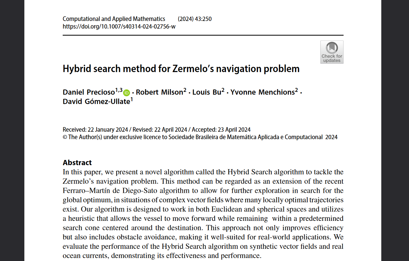
<p>The aim of Weather Navigation is to develop state of the art algorithms to tackle the Zermelo’s navigation problem. In the paper, our researchers present a novel method called “Hybrid Search”, that can be regarded as an extension of the recent Ferraro–Martín de Diego-Sato algorithm to allow for further exploration in search for the global optimum, in situations of complex vector fields where many locally optimal trajectories exist. Our algorithm is designed to work in both Euclidean and spherical spaces and utilizes a heuristic that allows the vessel to move forward while remaining within a predetermined search cone centered around the destination. This approach not only improves efficiency but also includes obstacle avoidance, making it well-suited for real-world applications. We evaluate the performance of the Hybrid Search algorithm on synthetic vector fields and real ocean currents, demonstrating its effectiveness and performance.</p>

<p><img src="https://weathernavigation.com/images/2024-05-20-hybrid-search.png" alt="Hybrid Search" width="100%" /></p>

<p>Zermelo’s navigation problem has a very impactful application in real scenarios: weather routing. This implies using information from ocean current forecasts to choose the best route for a shipping vessel, minimizing its travel time and GHG emissions, while also increasing the security of the journey.</p>

<p><a href="https://doi.org/10.1007/s40314-024-02756-w" class="button">Read the new paper here</a></p>

<p>This research is supported by:</p>

<ul>
  <li>
    <p><a href="https://www.fbbva.es/">BBVA Foundation</a> via the project “Mathematical optimization for a more efficient, safer and decarbonized maritime transport”.</p>
  </li>
  <li>
    <p>Spanish <a href="https://www.aei.gob.es/">Agencia Estatal de Investigación</a> under grant  TED2021-129455B-I00, “Optimization of maritime routes with real time oceanographic and meteorological data”.</p>
  </li>
</ul>]]></content><author><name>Weather Navigation</name></author><category term="weather routing" /><category term="optimization" /><category term="mathematics" /><category term="computational and applied mathematics" /><category term="springer" /><category term="publication" /><category term="journal" /><summary type="html"><![CDATA[We published a new article, introducing our novel Hybrid Search method to tackle Zermelo's navigation problem.]]></summary></entry><entry><title type="html">Weather Routing Demo Now Live</title><link href="https://weathernavigation.com/news/2024/demo" rel="alternate" type="text/html" title="Weather Routing Demo Now Live" /><published>2024-05-10T00:00:00-07:00</published><updated>2024-05-10T00:00:00-07:00</updated><id>https://weathernavigation.com/news/2024/demo</id><content type="html" xml:base="https://weathernavigation.com/news/2024/demo"><![CDATA[<p>After some months of hard work from our development team, we are proud to release an online demostration of our weather routing algorithms. This demo, publicly available through our landing page, showcases some sample routes and the savings achievable by mathematical optimization.</p>

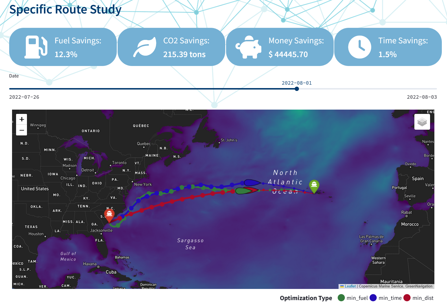
<p><img src="https://weathernavigation.com/images/2024-05-10-demo.png" alt="El País" width="100%" /></p>

<p><a href="https://demo.weathernavigation.com/" class="button">You can try the demo here</a></p>

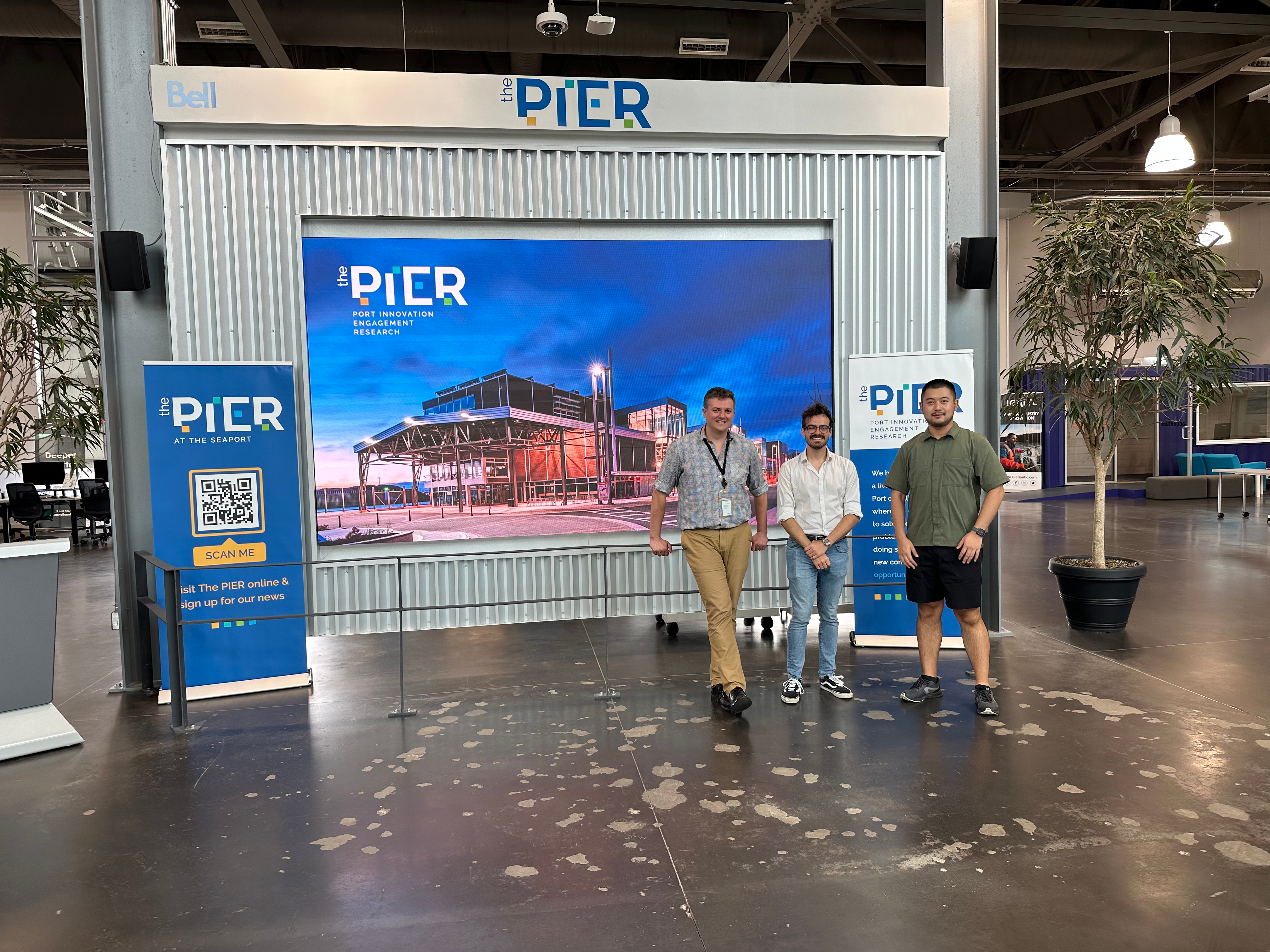
<p>We want to thank <a href="https://www.fbbva.es/">Fundación BBVA</a> and <a href="https://www.aei.gob.es/">Agencia Estatal de Investigación</a> for making this project possible through their funding and support.</p>]]></content><author><name>Weather Navigation</name></author><category term="demo" /><category term="weather routing" /><category term="optimization" /><category term="mathematics" /><summary type="html"><![CDATA[A public weather routing demo is now available in our Weather Navigation website.]]></summary></entry><entry><title type="html">Weather Navigation Returns to The PIER in Halifax</title><link href="https://weathernavigation.com/news/2024/pinsight" rel="alternate" type="text/html" title="Weather Navigation Returns to The PIER in Halifax" /><published>2024-04-25T00:00:00-07:00</published><updated>2024-04-25T00:00:00-07:00</updated><id>https://weathernavigation.com/news/2024/pinsight</id><content type="html" xml:base="https://weathernavigation.com/news/2024/pinsight"><![CDATA[<p>Our research team travelled to Halifax (Canada) to participate in <strong>PINsight 2024</strong>, an innovation forum organised by <a href="https://thepierhfx.com/"><strong>The PIER</strong></a> under the umbrella of the <strong>Port Innovators Network (PIN)</strong>. The event convened representatives from leading ports, accelerators, and technology providers to exchange best practices in digital decarbonisation.</p>

<p>During the technical session, we presented our weather routing solution: a decision‑support platform that fuses high‑resolution meteorological and oceanographic forecasts with multi‑objective optimisation to reduce voyage emissions, fuel consumption, and operational risk.</p>

<p align="center"><img src="https://danielprecioso.com/images/2024-04-25-pinsight.jpeg" width="100%" /></p>

<p>This visit marks our <strong>second collaboration stint at The PIER</strong>, reinforcing a partnership aimed at translating academic research into operational value for the global port community.</p>

<p>This research is supported by:</p>

<ul>
  <li>
    <p><a href="https://www.fbbva.es/">BBVA Foundation</a> via the project “Mathematical optimization for a more efficient, safer and decarbonized maritime transport”.</p>
  </li>
  <li>
    <p>Spanish <a href="https://www.aei.gob.es/">Agencia Estatal de Investigación</a> under grant  TED2021-129455B-I00, “Optimization of maritime routes with real time oceanographic and meteorological data”.</p>
  </li>
</ul>]]></content><author><name>Weather Navigation</name></author><category term="weather routing" /><category term="the pier" /><category term="port innovators network" /><category term="maritime innovation" /><summary type="html"><![CDATA[Our weather routing solution featured at PINsight 2024 in Halifax, strengthening knowledge transfer between academia and global port‑innovation networks.]]></summary></entry><entry><title type="html">New Article in El País</title><link href="https://weathernavigation.com/news/2024/el-pais" rel="alternate" type="text/html" title="New Article in El País" /><published>2024-02-20T00:00:00-08:00</published><updated>2024-02-20T00:00:00-08:00</updated><id>https://weathernavigation.com/news/2024/el-pais</id><content type="html" xml:base="https://weathernavigation.com/news/2024/el-pais"><![CDATA[<p>Today we would like to share with you the article on our weather routing project that was published in Diario EL PAÍS. This article has been written by David Gómez-Ullate and David Martín de Diego, both researchers of this project.</p>

<p><img src="https://weathernavigation.com/images/2024-02-20-el-pais.png" alt="El País" width="80%" /></p>

<p><a href="https://elpais.com/ciencia/cafe-y-teoremas/2024-02-20/construyendo-el-google-maps-del-oceano.html" class="button">Read the full article (in Spanish)</a></p>

<p>We want to thank <a href="https://elpais.com/autor/agata-a-timon-garcia-longoria/">Ágata A. Timón García-Longoria</a> for her help editing the article and to <a href="https://www.fbbva.es/">Fundación BBVA</a> and <a href="https://www.aei.gob.es/">Agencia Estatal de Investigación</a> for funding the project.</p>]]></content><author><name>Weather Navigation</name></author><category term="el pais" /><category term="español" /><category term="spanish" /><category term="press" /><category term="mathematics" /><category term="icmat" /><summary type="html"><![CDATA[Today we would like to share with you the article on our weather routing project that was published in Diario EL PAÍS.]]></summary></entry></feed>